Pamlico Sound, the second largest ICW estuary after the Chesapeake Bay, is 65 miles south of Albemarle Sound (via the ICW) and deserves the same amount of respect.
The afternoon sea breeze, combined with prevailing southwesterlies, can often produce winds in excess of 20 knots and a short, steep chop that can fairly be called "vicious."
In November migratory waterfowl transiting the Atlantic Flyway visit the refuge area halfway between Englehard and Swanquarter. Swanquarter is the seat of Hyde County and the trading center for this area. It is also an embarkation point for ferries crossing Pamlico Sound to Ocracoke Island.

Navigating Pamlico Sound
If you are southbound, the entrance to the Pamlico River from the ICW is around the junction flashing red (2+1) "PR" (Mile 146) marking the shoal off Wades Point at the mouth of the Pungo River. Do not attempt to cut inside the marker unless you are very familiar with the area. Take care not to hit the unmarked, unlighted Mile 145 marker on the east side of the Pungo River prior to Wades Point.
Pamlico Sound markers are generally 5 to 15 miles apart so we strongly recommend that you run compass courses or GPS routes between them. Currents, often set up by the wind, can cause you to drift 10 to 15 degrees off course. Where these currents begin and end is impossible to predict but they are indeed there so check your position continually. Pamlico Sound, like any large sound, is a good area in which to use the GPS.
An alternative route to the ICW via the Croatan and Roanoke Sounds is covered in "Side Trip: The Albemarle & Roanoke Sounds, NC" in the Waterway Guide Mid-Atlantic Edition.
Anchorages on Pamlico Sound
The many bays west of Swanquarter Bay look good on the NOAA chart but they are low marsh, have soft bottoms and offer little protection. Large commercial trawlers use this entrance so be especially diligent here.
Wysocking Bay to the south beyond Far Creek has a hard mud bottom and marshy borders with protection from chop except from the south to southeast. From July to April this harbor is likely to be busy with commercial fishing boats. Groceries, a hardware store and a hotel are to the north in the town of Englehard.
Juniper Bay, the next bay to the west, can be followed upriver to good protection and 6-foot MLW depths in soft mud. This location can be buggy on still summer nights.
The Long Shoal River to the north offers anchorage in 6 to 8 feet MLW in hard mud with a bit of wave break due to the encroaching shoals at the south entrance but no protection from the north. The next harbor to the north is Stumpy Point with good holding in around 6 to 8 feet MLW. This is a remote, peaceful area.


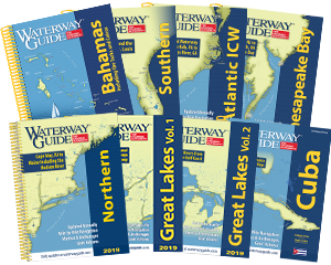
- 4,000 Marinas
- Thousands of anchorages
- Updated Charts
- Mile-by-Mile Navigation
- Highlighted Alerts & Cautions
- Full-Color Aerial Photographs

The Waterway Guide App Makes it easy to leave reviews, use our explorer, and view waterway guide materials all on the go!